- By Krishna Dev Joshi
Floodplains are often seen only as risky landscapes-places of erosion, inundation, sedimentation, and loss. But what if these same landscapes could become part of the solution? This is the vision of the BAGAR Project (Building Agroforestry-based Adaptation Plans for Resilient Floodplains) which is helping Marin Rural Municipality in Sindhuli and Gadhimai Municipality in Rautahat rethink their floodplains as living systems that can protect communities, restore ecosystems and support resilient livelihoods.
Both Marin and Gadhimai live with rivers that shape land, risk and opportunity. In Marin, the Marin River carries sand, gravel and boulders from the fragile Chure and Siwalik hills, creating dynamic riverbeds and erosion-prone floodplains. In Gadhimai, the Bagmati River moves across the flat Terai landscape, bringing annual floods, riverbank erosion, channel shifts and fertile but unstable alluvial deposits. These conditions make permanent structures risky but they also create space for seasonal farming, agroforestry, fisheries, wetlands and natural flood buffers.
The BAGAR Project is envisioning these floodplains not as wasted or abandoned land but as climate-resilient landscapes that can be restored and managed through Ecosystem based Adaptation (EbA) and Nature-based Solutions (NbS). Instead of relying only on hard infrastructure, the land use plans identify where nature can do part of the work; slowing flood flows, stabilizing riverbanks, trapping sediment, recharging water, restoring vegetation and reducing pressure on embankments.
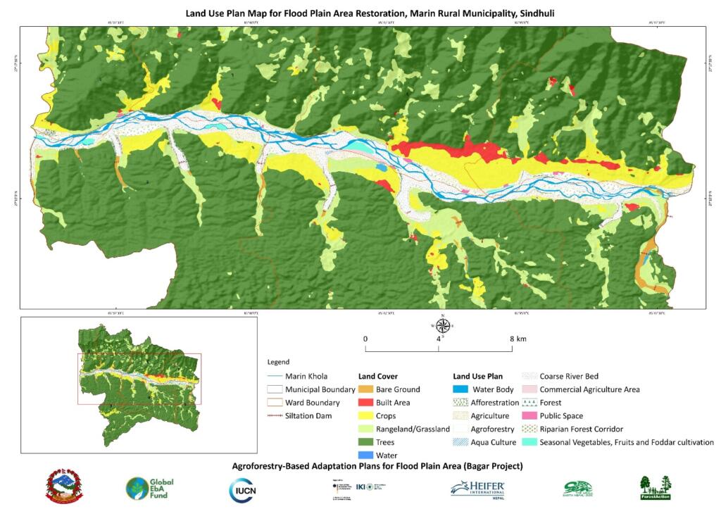
The floodplain land use plans classify land according to flood risk, including annual, 5-year and 10-year flood zones. High-risk river corridors are proposed as protection zones where permanent construction is restricted. These areas are prioritized for riparian tree corridors, bamboo and banana-based agroforestry, vetiver and grass strips, forest buffers, wetlands, bio-dykes, vegetated spurs and riverbank restoration. Such interventions allow rivers to breathe while reducing damage to farms, settlements and infrastructure.
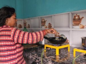
Livelihoods remain central to the plans. In Gadhimai, floodplain areas are proposed for seasonal cash crops and vegetables, flood-resistant cash crops, aquaculture, agroforestry, embankment tree corridors and water body conservation. In Marin, the plan promotes agroforestry systems, riparian tree corridors, seasonal agriculture, artificial wetlands and fisheries, forest and watershed conservation and traditional agriculture. These uses match the rhythm of floods rather than fighting against it.
What makes this approach powerful is its multiple benefits. Agroforestry can stabilize soils while generating income. Wetlands can store floodwater while supporting fish and biodiversity. Riparian buffers can reduce erosion while improving habitat. Seasonal agriculture can turn sandy riverbeds into productive land during safe periods. Together, these solutions strengthen climate resilience, diversify local incomes and restore degraded floodplain ecosystems.
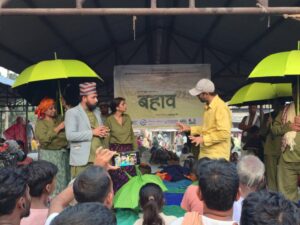
The plans were developed through a combination of GIS analysis, satellite imagery, field surveys, participatory mapping, ward-level consultations and indigenous knowledge. This makes them both scientific and locally grounded. Communities helped to identify flood-prone areas, traditional land uses, vulnerable settlements and practical adaptation options.
For Marin and Gadhimai, BAGAR offers a shift in thinking: floodplains are not only places to defend against floods but places to work with nature. By restoring them through EbA and NbS, municipalities can reduce disaster risk, protect ecosystems and create new livelihood opportunities. With strong local leadership, community ownership and regular monitoring, these floodplain land use plans can become practical roadmaps for resilient and nature-positive development.